Navionics+ Gold 44XG - Finland Small Card For Old Models


- Available to order onlineDelivery time approx. 1-10 business days
- Available to order onlineDelivery time approx. 1-10 business days
Navionics Gold-44XG 1GB is a compatible chart card for all Lowrance and Humminbird chartplotters and combo units we sell.
The 1GB and 2GB cards are intended for older devices that do not support the new 8GB or 16GB chart cards. Otherwise the chart itself has the same features as the larger chart cards.
Navionics Gold 44 XG 1GB chart includes:
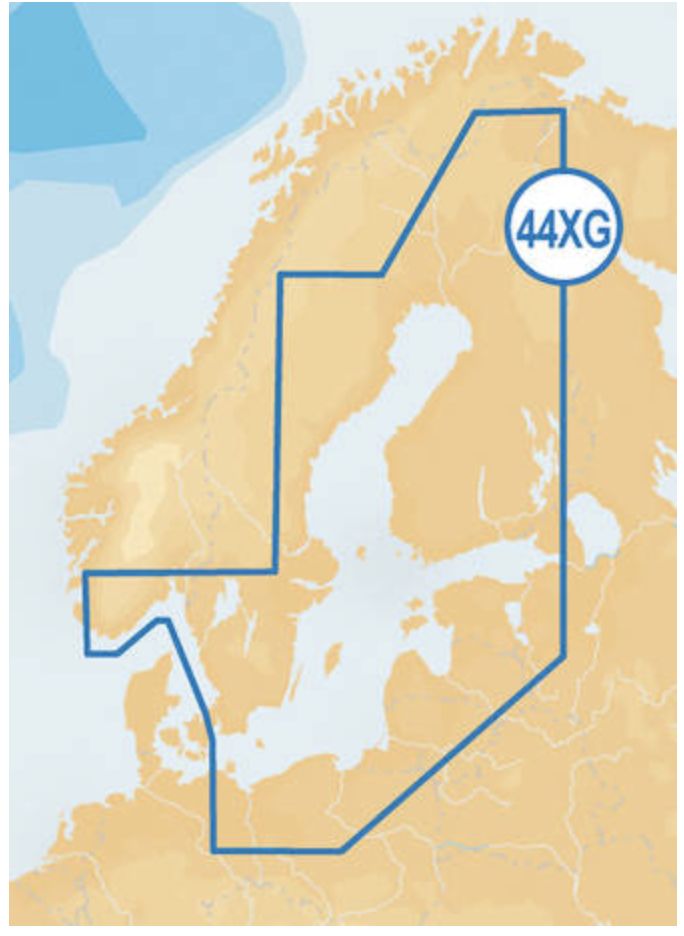
- Marine areas: the entire Baltic Sea
- Finnish lakes: all the largest lakes and waterways as well as a large number of smaller lakes
- Swedish lakes: Vänern and Vättern as well as other smaller lakes
- Navionics Gold charts also include small boat routes. Electronic charts are an aid to navigation to be used together with official paper charts. Electronic charts are not intended to replace official paper charts. Only official charts and Notices to Mariners contain the information required for safe navigation. As always, the captain of the vessel is responsible for the navigation methods.
- The Navionics Gold 44 XG chart is on a microSD card, but an SD card adapter is also included. It works as an adapter for the microSD card in devices that require an SD card.
SonarChart
SonarChart, our 1 ft contoured chart layer, gives you a detailed view of shallow waters, ledges, humps and more.
Discover the "Top Five Reasons" to use SonarChart in this video by our ProStaffer.
Fish Attractors
Fish seek out particular types of habitats where they prefer to nest. In many lakes and coastal waters, angling clubs and fisheries organizations will sink structures to attract fish and encourage a healthy fishery. Navionics charts include more than 10,000 fish attractors.
SonarChart Live
With SonarChart Live, you can count on the most up-to-date information because the bathymetry is drawn on the screen of your device in real time. When you create your own maps, you can feel confident that you're making decisions based on the most recent depth data.
Fishing Ranges
Fishing Ranges will help you interpret the structure, identify patterns and focus on where to cast.
Advanced Map Options
Customize your view of Navionics charts to highlight shallow areas, adjust SonarChart contour density, and target a fishing range!
SonarChart Shading
A detailed rendering of the seafloor and lake bottoms in varying shades of blue offers anglers clear visual cues to identify fish-holding structure at a glance.
Product text updated 26.9.2026.


