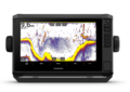
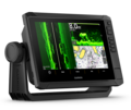
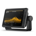
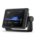
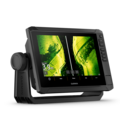
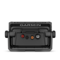
Garmin Echomap UHD2 92sv Touch

Side imaging sonar with a 9" touchscreen
Garmin Echomap UHD2 92sv Touch - Garmin Fish Finders & Chartplotters - 010-02687-00 - 1
Garmin Echomap UHD2 92sv Touch - Garmin Fish Finders & Chartplotters - 010-02687-00 - 2
Garmin Echomap UHD2 92sv Touch - Garmin Fish Finders & Chartplotters - 010-02687-00 - 3
Garmin Echomap UHD2 92sv Touch - Garmin Fish Finders & Chartplotters - 010-02687-00 - 4
Garmin Echomap UHD2 92sv Touch - Garmin Fish Finders & Chartplotters - 010-02687-00 - 5
Sale -32%
Garmin Echomap UHD2 92sv Touch - Garmin Fish Finders & Chartplotters - 010-02687-00 - 1
Garmin Echomap UHD2 92sv Touch - touchscreen with keyed-assist chartplotter knows the water better than a local. Its bright, sunlight-readable display offers improved detail and clarity. See clear... Read more
879,90 € - 1 019,00 €
Up to -23%
Price valid until 01.12.2026
Choose Transducer
879,90 €
-23%
RRP 1 139,00 €
Offer! You save 259,10 €
Price valid until 01.12.2026
Without transducer
  • Product temporarily out of stock
1 019,00 €
-32%
RRP 1 499,00 €
Offer! You save 480,00 €
Price valid until 01.12.2026
Side scanning transducer (GT56UHD-TM)
  • Available to order online
    Delivery time approx. 1-10 business days
pcs

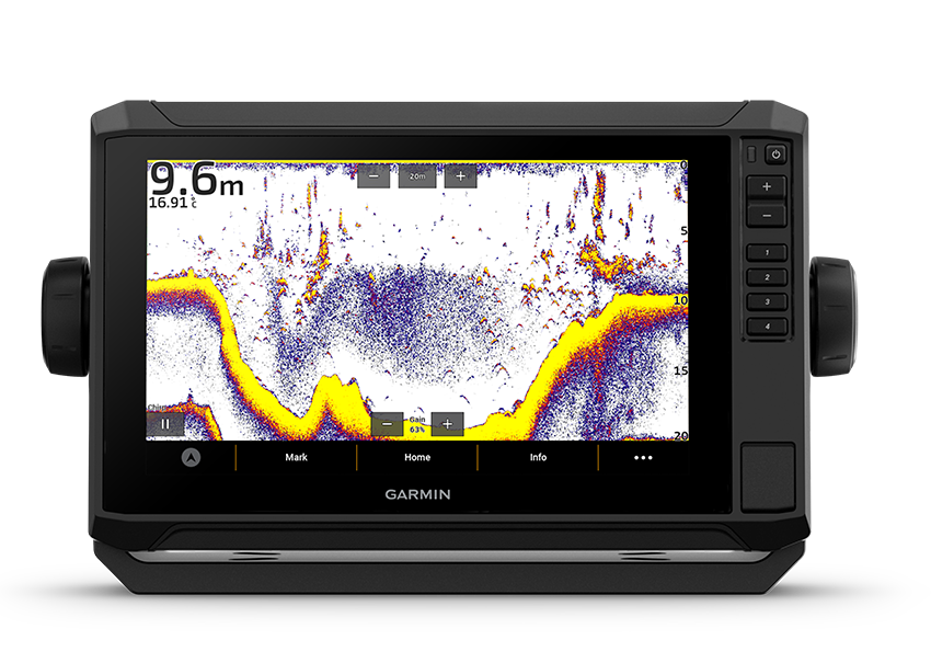
Garmin Echomap UHD2 92sv Touch - touchscreen with keyed-assist chartplotter knows the water better than a local. Its bright, sunlight-readable display offers improved detail and clarity. See clear, sharp fish arches with Garmin traditional sonar. ClearVü and SideVü scanning sonars feature vivid color palettes for clear, high-contrast views all around your boat. ECHOMAP UHD2 also supports LiveScope sonar systems. Navigate the waters with optional Garmin Navionics+ cartography, which comes with a 1-year subscription to daily chart updates. Built-in Wi-Fi connectivity lets you wirelessly share sonar, waypoints and routes with another ECHOMAP UHD2 chartplotter. Wherever you drop your line, get improved position accuracy, particularly in areas where signals are reflected or weak, with multi-band GPS. You can also pair with the free all-in-one ActiveCaptain app on your compatible smartphone for access to the OneChart feature, software updates and more. The chartplotter supports NMEA 2000 networks to connect your compatible autopilots, digital switching, music and more to view all on one screen.

Garmin Echomap UHD2 92sv Touch Main Features: 

  • Easy-to-use touchscreen with keyed assist with a bright, sunlight-readable display. 
  • 9" units now feature increased screen resolution (1024 x 600) when compared to previous models. 
  • See below your boat with Garmin traditional, ClearVü and SideVü scanning sonars with vivid color palettes. Compatible with LiveScope live scanning sonar. 
  • Built-in Wi-Fi connectivity lets you wirelessly share sonar, waypoints and routes with another ECHOMAP UHD2 chartplotter. 
  • Experience unparalleled coverage and detail with optional Garmin Navionics+ integrated mapping or optional Garmin Navionics Vision premium mapping with relief shading, satellite imagery, Auto Guidance+1 and more. They even come with a 1-year subscription for downloadable daily updates. 
  • Includes multi-band GPS, which utilizes multiple frequencies for improved position accuracy, particularly in areas where signals are reflected or weak. 
  • Supports wired NMEA 2000 network connectivity. 
  • Pair with the free all-in-one ActiveCaptain app on your compatible smartphone for access to the OneChart feature, software updates and more. 
  • Wirelessly connects to your Force trolling motor to create and follow routes, navigate to waypoints, control speed, check battery life and more.

Updates from the previous version:

  • Redesigned display dock (the same quick-release dock as in the ECHOMAP Ultra series), which lets the display click into place easily and release from the dock quickly and effortlessly.
  • Garmin ECHOMAP UHD2 9" display
  • Available without transducer, with GT54 or with GT56 transducer
  • Package includes power cable, tilt/swivel mount and quick-release mount, screws and user manuals
  • Unit dimensions (W x H x D): 26.4 x 16.6 x 8.0 cm
  • Display size (W x H, diagonal): 19.8 x 11.5 cm, 22.9 cm
  • Display resolution: 1024 x 600 px
  • Water rating: IPX7
  • Internal GPS receiver: Yes
  • Internal receiver rate: 10 Hz
  • Garmin Navionics+: Yes
    Note! BlueChart g3 and BlueChart g3 Vision do not work with this unit
  • Auto Guidance+: Yes, with supported charts
  • Memory card slot: Yes, 1 microSD card; max. 32 GB
  • Waypoints: 5000
  • Track points: 50,000
  • Tracks: 50 saved tracks
  • Routes: 100
  • Sailing features: Yes
  • Built-in sonar: Yes
  • Traditional sonar: Yes
  • Sonar frequencies: Traditional: single-channel CHIRP, 50/77/83/200 kHz, L, M, H CHIRP; Garmin ClearVü and SideVü: 260/455/800/1000/1200 kHz
  • Transducer port pins: 12-pin
  • Wi-Fi connectivity (local): Yes

Product text updated 26.9.2026.

Recommended Products

Garmin Navionics+ Baltic Sea - Chart Cards - 010-C1273-20 - 1
Garmin Navionics+ Baltic Sea - Chart Cards - 010-C1273-20 - 2
Sale -18%
Garmin

Garmin Navionics+ Baltic Sea

Marine Charts EU644L
Garmin Navionics+ Baltic Sea - Marine Charts - IT'S A WHOLE NEW LOOK ON YOUR CHARTPLOTTER - Featuring vibrant colours, a streamlined interface and combined coastal/inland content with a popular...
(0)
179,90 €RRP 219,90 €
Product temporarily out of stock
Garmin Navionics+ Finland Lakes - Chart Cards - 010-C1254-20 - 1
Garmin Navionics+ Finland Lakes - Chart Cards - 010-C1254-20 - 2
Sale -7%
Garmin

Garmin Navionics+ Finland Lakes

Marine Charts EU055R
Garmin Navionics+ Finland Lakes - Marine Charts - IT'S A WHOLE NEW LOOK ON YOUR CHARTPLOTTER - Featuring vibrant colours, a streamlined interface and combined coastal/inland content with a popular...
(0)
139,90 €RRP 149,90 €
Available in stock
The product will be sent in 3-4 days
Garmin Navionics+ Vision Baltic Sea - Chart Cards - 010-C1273-00 - 1
Garmin

Garmin Navionics+ Vision Baltic Sea

Marine Charts EU644L
Garmin Navionics+ - Baltic Sea - A completely new look for your chartplotter! Garmin Navionics+ charts feature vibrant colors, a streamlined user interface, and combined coastal/inland content as well...
(0)
299,90 €
Product temporarily out of stock
Garmin Navionics+ Vision Gulf of Finland - Chart Cards - 010-C1249-00 - 1
Garmin

Garmin Navionics+ Vision Gulf of Finland

Map card EU644L
Garmin Navionics+ Vision Gulf of Finland chart card (product code 010-C1249-00) offers a comprehensive chart solution for Garmin chartplotters. This chart card includes detailed maps covering the Gulf...
(0)
249,90 €
Immediately from our warehouse
The product will be sent in 2 days
Have you purchased this product before?
Product
Service and delivery
A nickname of your choice that we'll show next to your review.
By submitting your review, you agree to give us the permission to publish it on this website as well as on other sites and media. Ruoto.com reserves the right to not publish the review. By submitting, you agree to these terms.
Free shipping for orders over 150,00 €
Economy Shipping
Economy Shipping
8,99 €
Free shipping for orders over 99,00 €
Posti Parcel Baltic
Posti Parcel Baltic
5,99 €
Normal prices
Omniva Pick Up
Omniva Pick Up
6,99 €
GLS FlexDeliveryService
8,99 €
Express Shipping (DHL Express)
11,99 €
Pickup of a firearm or firearm part from Finland + permit fees
119,90 €
Delivery of a firearm or firearm part to an EU country + permit fees
249,90 €
Lowest price in the last 30 days: 789,90 €