
- Product Code: 010-C1273-00
- EAN: 753759290474
- Warranty: 2 years
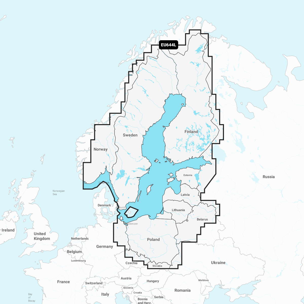
Garmin Navionics+ - Baltic Sea - A completely new look for your chartplotter! Garmin Navionics+ charts feature vibrant colors, a streamlined user interface, and combined coastal/inland content as well as a popular Navionics®-style color palette. It allows you to easily plan a route with products from the market's most popular boating chart manufacturer.
Garmin Navionics Vision+
The most up-to-date Garmin Navionics Vision+ premium marine charts are an all-in-one solution that provides high-quality, detailed chart information from coastal areas, lakes, rivers, etc. Features include depth shading, 3D views, satellite images, advanced Auto Guidance+TM technology1, and continuous chart updates via the ActiveCaptain® app. The latest chart information is available every time the boat leaves the dock. By combining the best features of Garmin and Navionics® automatic routing, Auto Guidance+ has been achieved, which suggests a dock-to-dock route and guides through channels, straits, marina entrances, etc. Various shading options help navigate shallow waters and are useful for selecting depth areas for the best fishing spots.
Garmin Navionics Vision+ key and new features:
- Integrated Garmin and Navionics content from coastal and inland areas in a renewed color palette and Navionics-style appearance. Excellent coverage, clarity, and detail.
- Continuous chart updates included in a one-year subscription via the ActiveCaptain smart device app.
- Internal Auto Guidance+ technology1 uses the given depth and clearance height as well as chart data and frequently used routes to calculate a dock-to-dock route suggestion.
- Depth contours at 0.5-meter intervals provide a more detailed view of the bottom shapes. They are useful for fishing and navigation.
- Detailed shading combining colors and shadows provides an easily interpretable and clearer view of the bottom shapes than just contour lines.
- Accurate satellite images as an overlay on the navigation chart provide a realistic view of the surroundings. They are very useful when arriving at an unfamiliar harbor. Aerial images of harbors, bridges, docks, navigation-supporting landmarks, etc., provide a better view of the environment above the waterline.
- Unique 3D views, such as MarinerEye and FishEye, provide additional perspective above and below the waterline.
- In depth area shading, you can choose from up to 10 color options and check the target depth at a glance.
- Shallow water shading useful for navigation highlights depth areas up to the user-defined level.
- ActiveCaptain community content includes useful points of interest, recommendations, and advice from other boaters who know the local environment.
Features in Garmin Navionics Vision+ map that are not in Garmin Navionics+ map:
- Depth difference shading: via ActiveCaptain app
- Accurate satellite images: via ActiveCaptain app
- Aerial images: Yes
- 3D Fish Eye view: Yes
- 3D Mariner Eye view: Yes
Comprehensive chart solution for Garmin chartplotters - Get detailed maps that include coasts, lakes, and rivers. Integrated Garmin and Navionics content helps boaters worldwide.
Daily chart updates - Charts are continuously supplemented with new and modified content. Up to 5,000 updates can be made per day. With the included one-year subscription, you get daily chart updates via the ActiveCaptain app on smart devices.
AUTO GUIDANCE+ Technology - Internal Auto Guidance+ technology2 combines the best features of Garmin and Navionics automatic routing. It suggests a route between marinas, for example, through channels, straits, and marina entrances.
Depth area shading - In precise depth area shading, you can choose from up to 10 color shading options and view defined target depths at a glance.
Contours at intervals of up to 0.5m - Contours drawn at intervals of up to 0.5 meters clearly and in detail show the bottom shapes, facilitating both fishing and navigation, for example, in swamps, channels, harbors, and marinas.
Shallow water shading - In this function, the user can define the shading depth and thus avoid shallow water areas.
ACTIVE CAPTAIN community - Community-added content provides useful points of interest, such as marinas, anchorage spots, obstacles, and businesses. Get recommendations from people with personal experience of the local environment.
Depth difference shading - Detailed shading combining colors and shadows3 shows the bottom surface shapes more easily interpretable and clearer than just contour lines.
Accurate satellite images - Accurate satellite images ensure excellent situational awareness.
Aerial images - Harbors, marinas, bridges, docks, boat ramps, dams, and navigation landmarks are particularly clearly visible in aerial and surface images, enhancing situational awareness above the water surface.
3D FISHEYE View - In this underwater view, the bottom and its shapes are visible in 3D from below the water surface. The view can be customized by adding sonar data.
3D MARINEREYE View - In this view, the environment is visible in 3D both above and below the water surface.
Compatible samples:
- Garmin Echomap UHD
- Garmin Echomap Ultra
- GPSMAP 1022/xsv, 1222/xsv, 1222/xsv Plus, 1223/xsv, 723/xsv, 923/xsv, 8410/xsv, 8412/xsv, 8416/xsv, 8417 MFD, 922xsv Plus